Maritime Security of Ukraine. A Reference Work. (6) "Historical Waters" of the Sea of Azov and the Kerch Strait
Bohdan USTYMENKO,
M.J., Attorney at Law
Tetiana USTYMENKO,
S.J.D., professor,
Department of Civil Law and Procedure
National Academy of Internal Affairs
From the editors of BlackSeaNews
On 7 December 2021, the interdepartmental working group chaired by Secretary of the National Security and Defence Council (NSDC) of Ukraine Oleksiy Danilov completed work on the draft Maritime Security Strategy of Ukraine, a document initiated by President of Ukraine Volodymyr Zelensky.
The strategy was developed taking into account the current experience of the world's leading maritime powers, the positions of maritime law scholars, the proposals of 16 government agencies, independent experts, and business associations. The working group members approved the draft, and the final text of the document, after coordination of some positions, was sent to the President of Ukraine and members of the NSDC of Ukraine.
The strategy took into account a lot of proposals aimed at solving problems that had been repeatedly addressed in the publications by BlackSeaNews authors. Therefore, the editorial board has decided to create a concise and clear reference work based on the contributions from our authors, which looks at the terminology and problems related to maritime security and provides expert explanations.
Contents
(1) The State Border of Ukraine at Sea
(3) The Exclusive Economic Zone and the Continental Shelf
(4) Ukraine's Maritime Borders With Turkey and Romania
(5) Ukraine's Maritime Borders With the Russian Federation
(6) "Historical Waters" of the Sea of Azov and the Kerch Strait
(7) "Internal Waters" and Borders in the Sea of Azov and the Kerch Strait
(8) The Tuzla Island Conflict and the Agreement Under Duress
(11) Foreign Military Exercises in the Exclusive Economic Zone of Ukraine
(12) The Legal Aspects of Hydrocarbon Extraction in the Exclusive Economic Zone of Ukraine
(13) The Prohibition Against Vessels and Ships Entering the 12-Mile Zone of the Crimean Peninsula
(14) Threats of Maritime Formats Involving the Russian Federation
(15) Necessary Legal Measures Ukraine Should Take
* * *
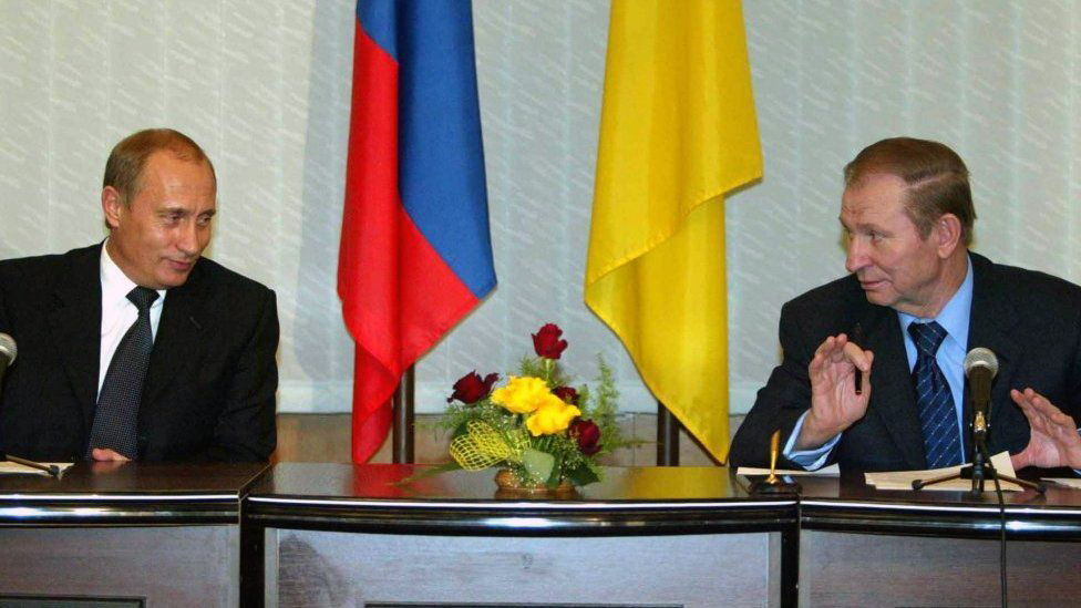
On December 24, 2003, in the Ukrainian city of Kerch, President of Ukraine Kuchma and President of the Russian Federation Putin signed a document entitled an Agreement Between Ukraine and the Russian Federation on Cooperation in the Use of the Sea of Azov and the Kerch Strait [1], hereinafter — the Kerch Treaty.
Article 2 of the Agreement includes the following clauses:
1. Merchant ships and warships, as well as other government ships flying the flags of Ukraine or the Russian Federation operated for non-commercial purposes, enjoy freedom of navigation in the Sea of Azov and the Kerch Strait.
2. Merchant ships flying the flags of third countries may enter the Sea of Azov and pass through the Kerch Strait when heading to or returning from a Ukrainian or Russian port.
3. Warships or other government ships of third countries operated for non-commercial purposes may enter the Sea of Azov and pass through the Kerch Strait when heading for a visit or business call to the port of one of the Parties on the invitation or permission of that Party approved by the other Party.
That is, among other things, the Kerch Treaty stipulates that warships or other government ships of third countries operated for non-commercial purposes invited by Ukraine, may not enter the Sea of Azov and pass through the Kerch Strait without the consent of the Russian Federation.
Also, the first paragraph of Article 1 of the Kerch Treaty states that historically, the Azov Sea and the Kerch Strait are internal waters of Ukraine and the Russian Federation.
About 150,000 years BC Crimea already had a number of Neanderthal settlements later uncovered by archaeologists. The first ethnic groups in Crimea that can be named were the Cimmerians and Tauri (I millennium BC).
The VII - V centuries BC in Crimea saw the establishment of Pantikapai (modern Kerch area), Chersonese (modern Sevastopol), Kercinitida (modern Yevpatoria), Feodosia and other settlements founded by the Greek colonists.
As the centuries passed, a variety of peoples, cultures and cities appeared and disappeared on the Crimean peninsula. At one point, the region became the last refuge for the Scythian Statehood — from the 2nd century BC to the 3rd century AD, the late Scythian State with the capital in Naples Scythian thrived in the area of present-day Simferopol.
At different times, Crimea was under to the Roman Empire, the Goths, Huns, Byzantium, Khazars, Pechenegs, Polovtsians and other peoples. In the 10th-11th centuries the Eastern Crimea was most likely part of the Tmutarakan principality that in turn, was part of the Kievan Rus.
In the 13th century, the Mongolian army of Khan Batu conquered Crimea and the peninsula became part of the Golden Horde.
Later, between 1441 and 1783, for almost 350 years, Crimea, the North Azov and the Black Sea areas were part of the Crimean Tatar state of Crimean Khanate.
In 1783, the Khanate was annexed by the Russian Empire, which had sealed the fate of the peninsula for the next 134 years, after which, in 1917, the empire itself ceased to exist as a subject of international law.
As for the history of the Sea of Azov and the Kerch Strait, the following recap is quite telling.
In ancient times, the Kerch Strait was called the Bosporus Cimmerian.
It’s a well-known fact that the Greeks called the Sea of Azov the Meotian lake, the Romans — the Meotian swamp, the Meotians — Temerinda, the Arabs — Baral-Azov, the Turks - Bahr-Assak, the Slavs — the Blue Sea or according to another version, the Suezian Sea, the Genoese — Mare Tane and so on.
Each people that lived in the Crimean peninsula, modern Kherson, Zaporizhia, Donetsk, Rostov and Krasnodar regions, when using the Sea of Azov, gave it its own name.
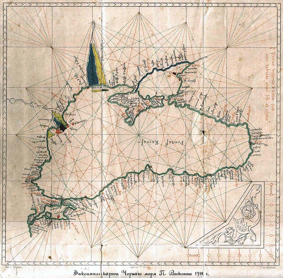
Starting with the Middle Ages, the Genoese and Venetians began to draw the maps and nautical charts of the Sea of Azov.
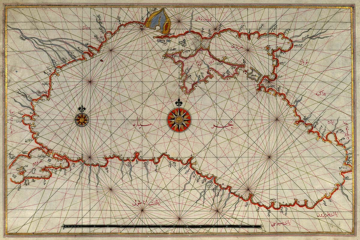
So, for thousands of years, the Sea of Azov — Lake of Meotia, Swamp of Meotia, Temerinda, Baral-Azov, Bahr-Assak, Suroz Sea, Mare Tane, etc. — has been used by numerous peoples, as evidenced by the abundant findings.
A curious footnote — while the Sea of Azov is the most shallow sea in the world, it is at the same time, the most continental one, i.e., the farthest from the ocean.
From 1921 to 1954, as part of the Union of Soviet Socialist Republics (USSR), Crimea was included in the Russian Soviet Federal Socialist Republic (RSFSR).
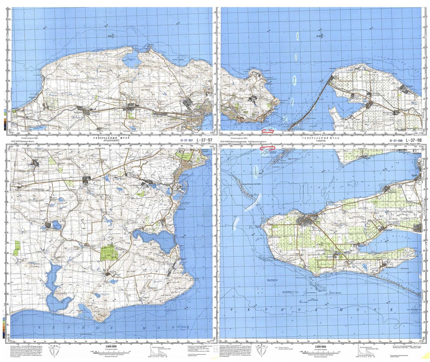
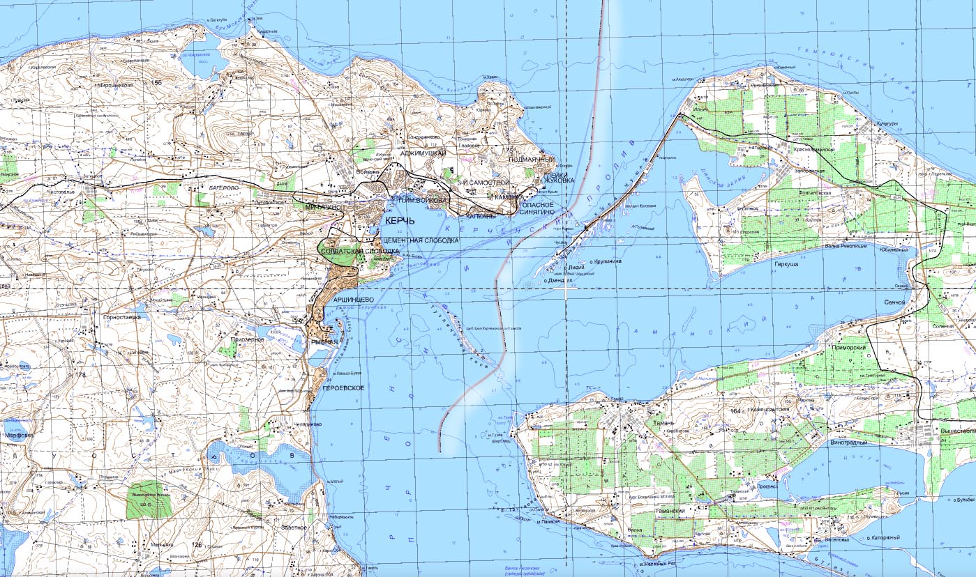
As evidenced by the Soviet documents, the administrative border in the Kerch Strait was defined between the Krasnodar Territory and the Crimean Autonomous Socialist Soviet Republic.
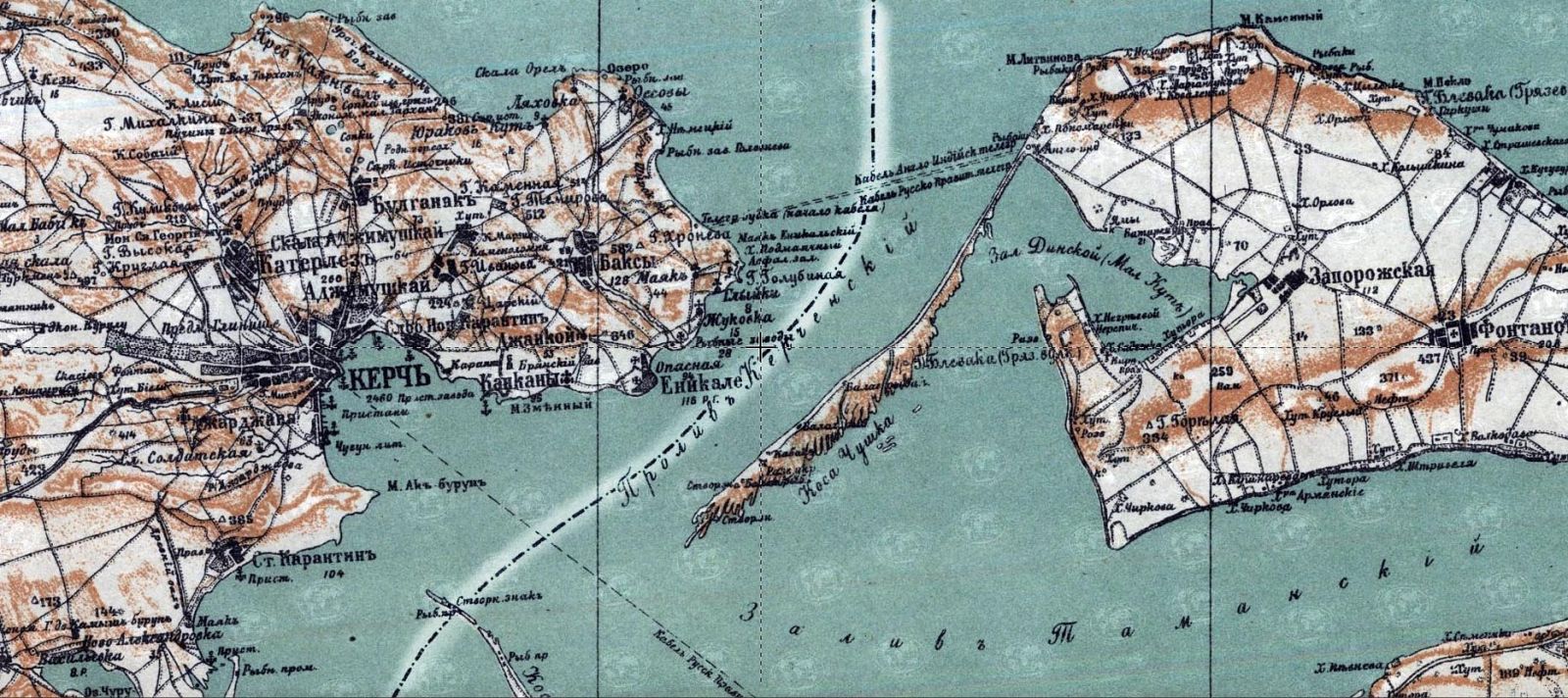
Map of Northern Caucasia, Krasnodar, 1926. The administrative border in the Kerch Strait was defined between the Krasnodar Territory and the Crimean Autonomous Socialist Soviet Republic. Photo: BSNews archive
Later, on the basis of the Law of the Supreme Soviet of the Union of Soviet Socialist Republics «On the Transfer of the Crimean region from the RSFSR to the Ukrainian SSR» the Crimean region was handed over from the RSFSR to the Ukrainian SSR.
At the time, some maps even showed the sea border between the republics.
Map of the USSR Joint Staff, 1989. The official Soviet map shows the administrative border between the USSR and the RSFSR in the Kerch Strait and the adjacent part of the Sea of Azov. Photo: BSNews archive
However, on June 12, 1990, the Congress of People's Deputies of the RSFSR declared the state sovereignty of the RSFSR followed by the declaration of Ukraine’s independence a year later, when on August 24, 1991, the Verkhovna Rada of the Ukrainian SSR proclaimed the creation of an independent Ukrainian state.
The state border between the Russian Federation and Ukraine in the Kerch Strait and the adjoining part of the Sea of Azov is printed on the official Russian map with the corresponding symbol. (in Russian) State Scientific and Implementation Center of Geoinformation Systems and Technologies of FSUE "GOSGISCENTR". 2001, M: 1: 200000. Photo: BSNews archive
Our historical flashback wouldn’t be complete, though, without the Agreement Establishing the Commonwealth of Independent States [5], hereinafter referred to as the Belovezh Agreement, that stated that as of the date of the agreement, the Union of Soviet Socialist Republics ceased it existence as a subject of international law and a geopolitical reality. That is, the Belovezh Agreement officially put a historic end to a superpower of the past, the Soviet Union.
All of the above clearly demonstrates that from the Neanderthals age in Tavrida-Crimea approximately 150, 000 years BC until present, the States under the names of Ukraine and the Russian Federation have been using the waters of the Sea of Azov and the Kerch Strait for less than 30 years.
Therefore, considering both the general historical background and the specific facts, the allegation that the waters of the Sea of Azov and the Kerch Strait mentioned in the Kerch Treaty have a certain «historical identity» are simply meaningless.
* * *
References:
- Treaty Between the Russian Federation and Ukraine on Cooperation in the Use of the Sea of Azov and the Kerch Strait from December 24, 2003, https://zakon.rada.gov.ua/laws/show/643_205.
- The decree of the Presidum of the USSR Supreme Soviet transferring the Crimea Oblast from the Russian SFSR to the Ukrainian SSR, April 26, 1954, https://archives.gov.ua/Sections/Crimea_50/photos_03.php?3.
- Declaration of State Sovereignty of the Russian SFSR: Declaration by the First Congress of People's Deputies of the Russian SFSR from June 12, 1990.
- Act of Declaration of Independence of Ukraine from August 24, 1991, https://zakon.rada.gov.ua/laws/show/1427-12.
- Agreement Establishing the Commonwealth of Independent States (Rus/Ukr) from December 8, 1991 (ratified on December 10, 1991), https://zakon.rada.gov.ua/laws/show/997_077 .
- United Nations Convention on the Law of the Sea (ratified by the Law of Ukraine On Ratification of the 1982 United Nations Convention on the Law of the Sea and the Agreement #728-XIV on the Implementation of Part XI of the 1982 United Nations Convention on the Law of the Sea" from June 3,1999), https://zakon.rada.gov.ua/laws/show/995_057.
- On Establishing the Provisional Special Parliamentary Commission for Ensuring Control over the State Border Regime in the Tusla Island Area, https://zakon.rada.gov.ua/laws/show/1235-15.
- On Ratification of the Treaty Between Ukraine and the Russian Federation on Cooperation in the use of the Sea of Azov and the Kerch Strait: a law of Ukraine from April 20, 2004.
- Vienna Convention on the Law of Treaties from May 23, 1969, https://zakon.rada.gov.ua/laws/show/995_118.
* * *
 This publication has been produced with the support of the European Endowment for Democracy (EED). Its contents do not necessarily reflect the official opinion of EED. Responsibility for the information and views expressed in this publication lies entirely with the authors.
More on the topic
- 19.12.2021 Maritime Security of Ukraine. A Reference Work. (15) Necessary Legal Measures Ukraine Should Take
- 19.12.2021 Maritime Security of Ukraine. A Reference Work. (14) Threats of Maritime Formats Involving the Russian Federation
- 19.12.2021 Maritime Security of Ukraine. A Reference Work. (13) The Prohibition Against Vessels and Ships Entering the 12-Mile Zone of the Crimean Peninsula
- 19.12.2021 Maritime Security of Ukraine. A Reference Work. (12) The Legal Aspects of Hydrocarbon Extraction in the Exclusive Economic Zone of Ukraine
- 18.12.2021 Maritime Security of Ukraine. A Reference Work. (11) Foreign Military Exercises in the Exclusive Economic Zone of Ukraine
- 17.12.2021 Maritime Security of Ukraine. A Reference Work. (10) What Mandatory Procedure for the Delimitation of the Maritime Border Between Ukraine and Russia Can Be Adopted
- 16.12.2021 Maritime Security of Ukraine. A Reference Work. (9) The Delimitation of the Sea of Azov and the Kerch Strait According to the UN Convention on the Law of the Sea
- 15.12.2021 Maritime Security of Ukraine. A Reference Work. (8) The Tuzla Island Conflict and the Agreement Under Duress
- 14.12.2021 Maritime Security of Ukraine. A Reference Work. (7) "Internal Waters" and Borders in the Sea of Azov and the Kerch Strait
- 12.12.2021 Maritime Security of Ukraine. A Reference Work. (5) Ukraine's Maritime Borders With the Russian Federation
- 11.12.2021 Maritime Security of Ukraine. A Reference Work. (4) Ukraine's Maritime Borders With Turkey and Romania
- 10.12.2021 Maritime Security of Ukraine. A Reference Work. (3) The Exclusive Economic Zone and the Continental Shelf